The Brisbane Water is a
saltwater estuary on the New South Wales Central Coast and Gosford sits at the
northern end of the estuary. Gosford is just over an hour north of Sydney. Take
the Northern Line/Newcastle train from Sydney and get off at Gosford station or
get off at Woy Woy, and take a nice ferry ride from the wharf behind the pub.

We’re standing at the lookout
on Presidents Hill in West Gosford. On the lefthand side of the estuary we can
see Green Point in the middle distance, at the foot of that hill. The hill is
Kincumba Mountain. The open water behind that looks like the Kincumber
Broadwater with Kincumber South on its shoreline. The furtherest land you can
see, just the right of that tree in the foreground, is Sydney. To the right of
Sydney we can little Lion Island and Commodore Heights in the Kur-ring-gai
Chase National Park. In front of Commodore Heights we can see Mount Ettalong on
the Woy Woy Peninsula. Look for the pale water tank halfway up Mount Ettalong. Behind
the tree in the foreground, we can see the unpopulated Rileys Island and, just
visible behind it to the right, a bit of the entirely populated St. Huberts
Island. Then we’re looking at Koolewong at the far end of Murphys Bay and Noonan
Point at the near end. The closest land on the righthand side is Point Clare
and the tree-lined railway line heading into Gosford. The open water you can
see through the trees in the right foreground is Fagans Bay, a nice little bay
even some locals don’t know about.

We’re looking now at Gosford
from Fagans Bay. This photo was taken on the 30th of July 2017. So
far, from a distance, Gosford looks the same as it has for the past 10 or so
years. When those towers go up along Mann Street and we’ll look at again then
from this viewpoint and see how different it looks.
We’re at the marina at the
Gosford Yacht Club, looking at Iguana Joe’s, as it’s still known to locals
since Iguanagate (Iguana’s has the white sail roof) the western stand of Gosford
stadium on Iguana’s left, West Gosford to the left of the stadium and
Presidents Hill looming behind them all. To the right of Iguana Joe’s we can
see a few cars along Dane Drive, the Gosford City Council tower behind the
trees and, on the hillside to its right, small apartment blocks that only look
like towers because they’re on a steep hillside. The closest thing on the right
edge of the photo is the yacht club building.
You can see more of those
apartment buildings from Gosford Wharf, on Dane Drive, through the rigging of
those lovely yacht moored at the wharf. That’s Iguana Joe’s again there on the
right edge of the photo. This is the wharf the big white ferry leaves from. It
does lunch cruisers around the Brisbane Water.
Gosford stadium’s official name
is Grahame Park and its nickname is “the prettiest stadium in the world”
because of the lovely views from the stands of the water and hills and ridges
of Brisbane Water. It's the home of the Central Coast Mariners.
Back to the yacht club for this
photo and you can see all the way down to Lion Island again with Point Clare
that long dark ridge on the righthand side of the photo.
Murphys Bay, on the western
shore of the Brisbane Water, taken near the Koolewong boat moorings. The bay
sweeps around past Tascott station (locals will notice the half hidden station
footbridge) then we can see Noonan Point and, the hills and ridge north of Gosford
itself. Behind the red and white yacht (middle right) we can see the long low
Point Frederick jutting out like a finger into the Brisbane Water. Behind it is
the wide mouth of Erina Creek and then, on the very right-hand edge of the
photo, part of Green Point’s low foreshore.
There’s the park on the very
tip of Point Fred on the left-hand edge of this photo, with Kincumba Mountain
in the middle. Kincumba Mountain looks its full size from this angle. You can’t
get a sense of its real size from the photo above from the Gosford Yacht Club.
Now we’re down on the Woy Woy
Peninsula, at the lower western corner of the Brisbane Water, looking
north-north-east at Kincumba Mountain again, the furtherest hill, in front of
it, and Mount Pleasant in Saratoga on the Saratoga/Davistown peninsula. In
between Mount Pleasant and the boat ramp at the bottom left-hand of this photo,
we can see Railway Street and Waterview Street on the western shore of the Woy
Woy Peninsula.
Now we’re down at the southern
end of the Brisbane Water and looking across to Palm Beach (left) Lion Island
(middle) and, on the right, Commodore Heights again. Lion Island is part of the
Brisbane Water National Park and is a nature reserve. For a nice view and a cup
of coffee, take the ferry from Ettalong across the Palmy and then back again.

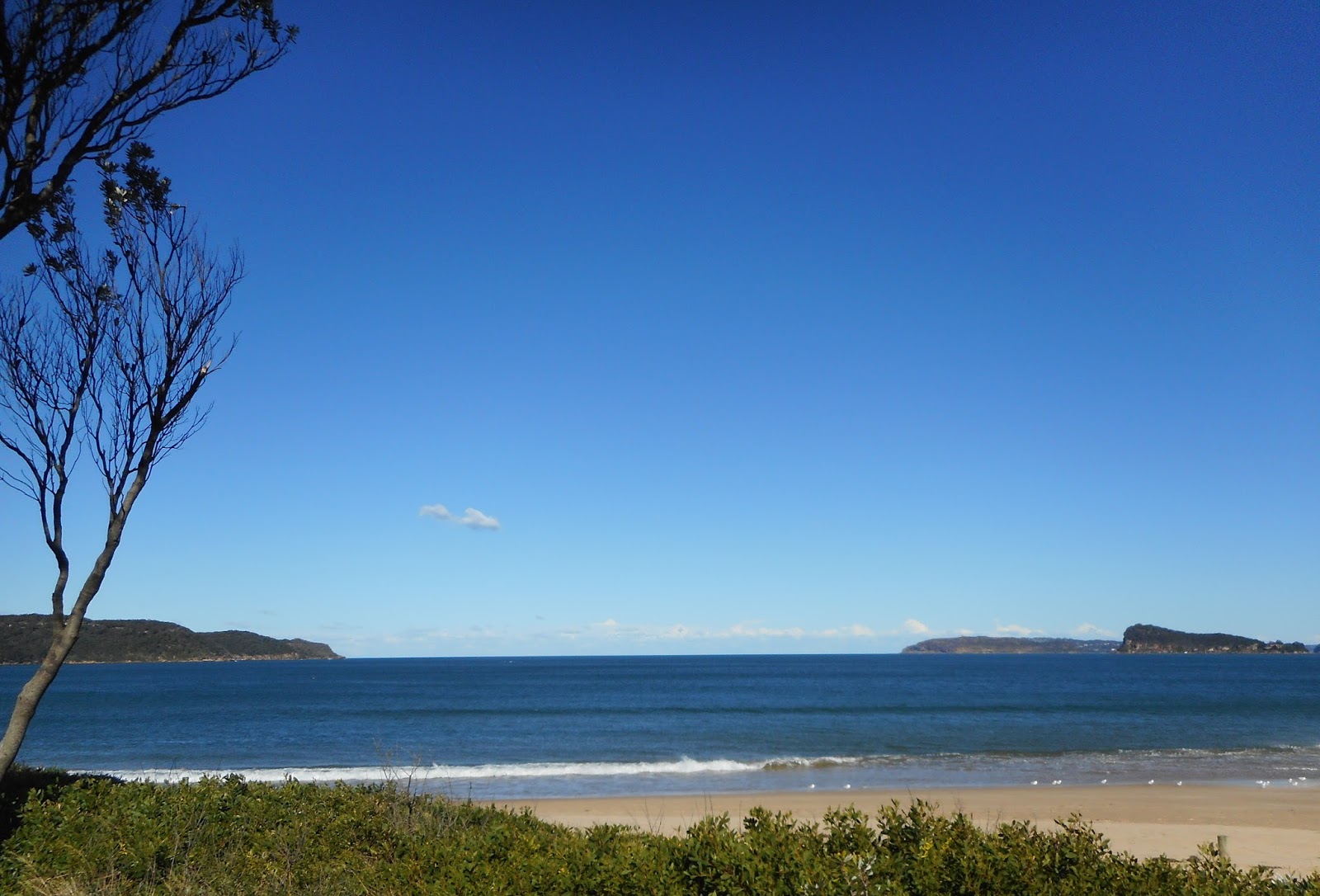
Umina Beach, just a week or so
ago and in the middle of an Australian winter. The skies are often blue here in
winter. In the middle of this photo, we can see the pale cliff at the southern
end of Pearl Beach, known locally as Pearly. Then we Mount Ettalong and, up on
the top of it now and halfway along, the pale paint of the water tank. And,
finally we’re back to the warm sands of the beach itself. Visitors love that
this lovely long beach is a single block, just 5 minutes walk, from the main
street of Umina Beach, West Street. From Woy Woy’s main drag, drive down Ocean
Beach Road, nose along West Street and turn right into Trafalgar Avenue or get
a bus from Woy Woy railway station.
At now we’re at the most
southerly end of the estuary and a bit beyond, looking from Umina Beach through
the heads of Broken Bay and out to the Tasman Sea between Australia and New
Zealand.
And all those lovely views above are within a 25 minute drive of Gosford, along the shores of the Brisbane Water and on the wide sandy beaches just beyond. Welcome to heaven.
Got something to say? Click
below on “comments” and type into the box that appears. Be nice.